
45 years in the Jericho Valley

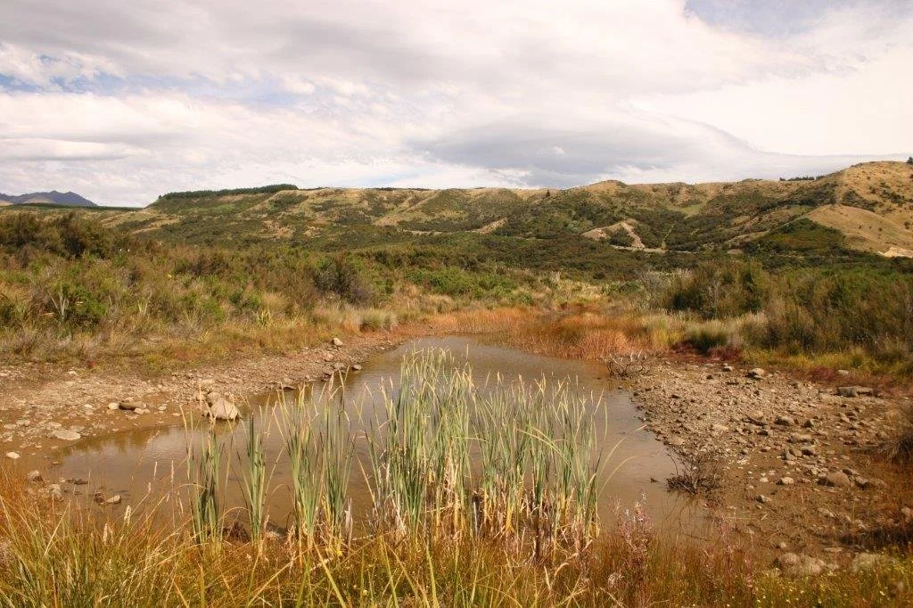
The wetland area along the high water flood diversion channel
Mark Sutton, from the Waiau Trust has seen first hand the transformation and regeneration at Te Kōawa over the last 45 years. He shares his experiences below.
“My first association with the Redcliff Valley (Te Koawa) area (apart from driving past the area) was in the winter of 1977 when I carried out a trout spawning survey on Redcliff Creek. This involved walking the length of the entire stream from it's confluence with the Waiau River to the first gorge area upstream of the end of the Te Kōawa property as it now is, counting redds* and fish by species. My memory of Te Kōawa at this time was an area of low tussock and native grasses, with very little high vegetation across the river flats. It was extensively grazed by cattle over the entire valley. I do not recall any broom or gorse except below the main road bridge. The Redcliff Creek berm along the main road downstream of the Trust’s buildings had a significant number of mature Kōwhai trees which were a notable feature. At about this time a new house was placed on the site of the current Lodge.
My next recollection was in the early 80s when a local digger operator was contracted by Lands & Survey Department to deepen and straighten out Jericho Stream as part of the land development programme. I was then working for the Southland Acclimatization Society (now Fish & Game), and there had been a lot of discussion (much of it acrimonious) about "land development" at this time. The compromise was that the stream as you see it today on the property was indeed deepened, but the meandering pattern was followed rather than straitening the stream into a drain. The work was pretty devastating to the fishery at the time, but looking at it on our recent visit to the site [in 2021] it would be hard to know now that this had happened. For whatever reason, this part of the greater Jericho Station was never developed into pasture as such. The flood diversion channel which is now where the two wetlands have been developed was completed at about the same time as the stream deepening by the Southland Catchment Board (now Environment Southland).
In about 2003/04 I was asked by the Te Waiau Mahika Kai Trust to look at options for developing open water wetlands on the valley site. This was subsequently carried out with the earthmoving contractors we were using at the time developing the Rakatu Wetland complex. The only suitable site was the "flood channel" area, with much of the valley being too steep or too dry in various locations. The wetlands seen today were created at that time.
In general, the revegetation of the valley is amazing to observe over my 45 years of knowing the area. Taking the long term view of "letting it restore itself" has to be the right approach.”
Mark Sutton
Field Officer, the Waiau Trust
August 2021


* A redd is an oval-shaped depression in the gravel, made by a female trout for spawning.